
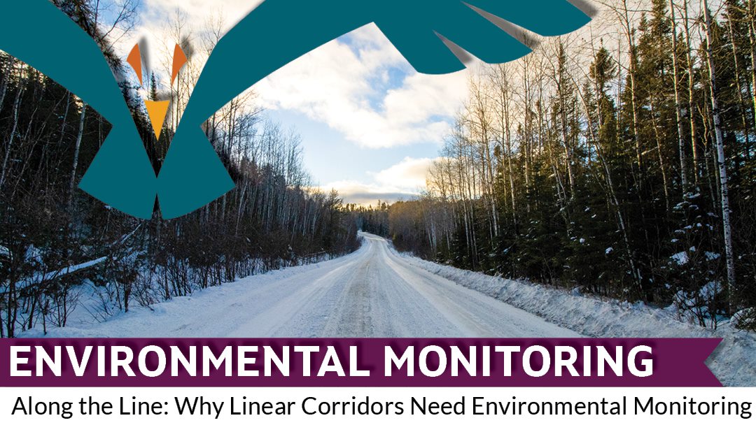
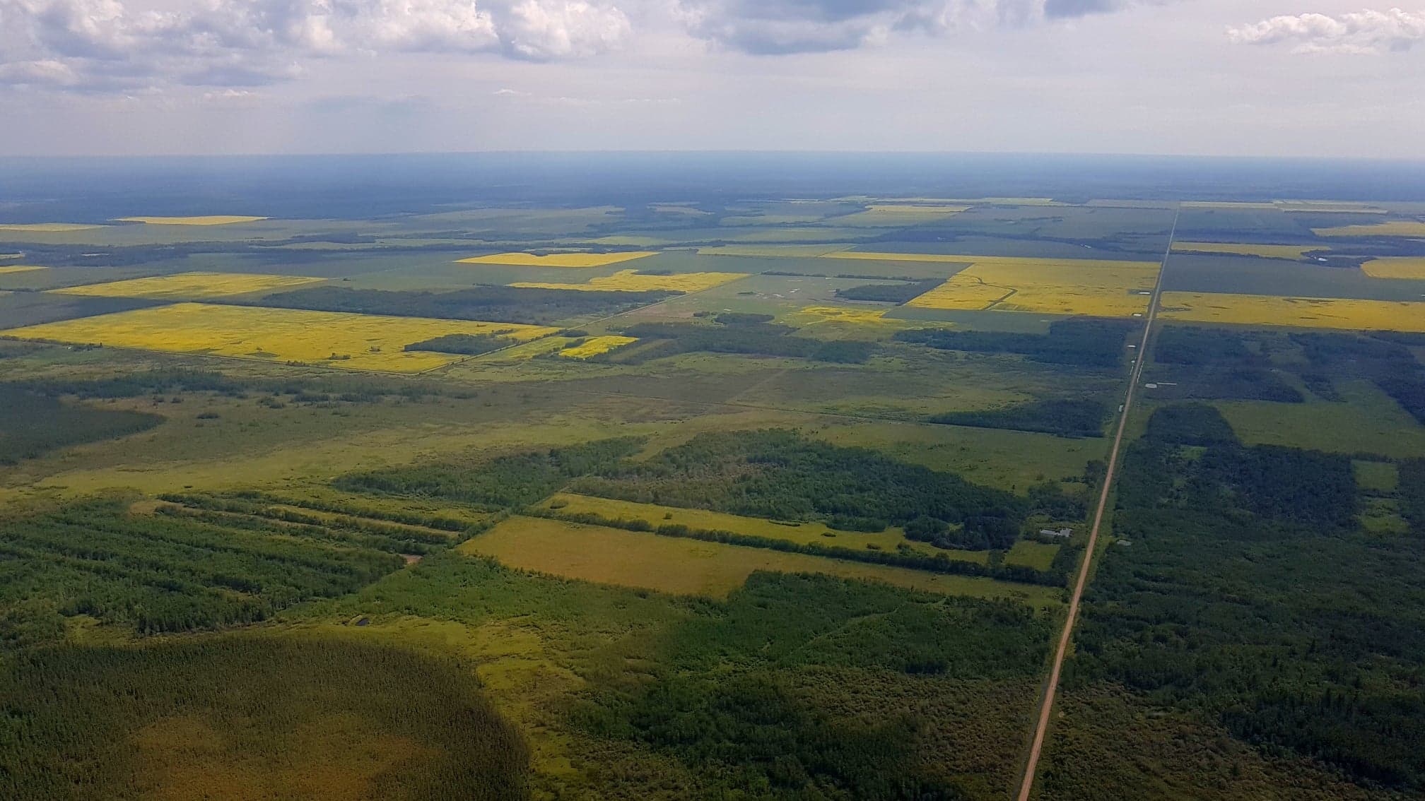
Today we are bringing back the final post from our environmental monitoring series. This is a topic that deserves to be heard again — linear corridors. What are linear corridors? They are roads, pipelines, transmission lines, rail lines — anything that passes through a natural area and creates a linear break in the landscape.
Why are linear corridors worthy of all this attention you ask? Well, it’s virtually impossible for a land-based development project to proceed without creating a linear corridor, whether it’s as basic as cutting an access road or as complex as a pipeline covering thousands of kilometers. Linear corridors pose several interesting environmental challenges — landscape disturbance, sight lines, altered ecosystems, unintended land use — but are an essential and unavoidable part of many projects. These disturbances have noteworthy impacts on lands, waters, animals, people, tourism, and land use. With a greater understanding of the potential impacts, Nations and communities can take appropriate steps to effectively monitor and manage linear disturbances.
"Long-term monitoring of these linear corridors avoids proponents being able to wash their hands of adverse impacts to the lands, waters, and people. It also helps set a standard of conduct that is based on responsibility and gets us closer to achieving a sustainable business model for resource management in Canada."
Understanding Linear Corridor Monitoring
What do we need to watch for?
“You really get a sense of the long-term impacts of linear disturbances, like roads, when you’re travelling along them on foot.” – Jasmine Labelle, SVS.
Disturbance to forest succession
One of the most notable observations about a linear corridor is the difference in the landscape — the difference between the corridor itself and the land bordering it, and also how well the land is recovering from the initial disturbance. If the corridor does not match the surroundings, that is a sign that the area should be monitored to measure the impacts of the disturbance on forest succession, for example. It’s because of monitoring that we can demonstrate that these disturbances have long-term effects.
Parasite and disease spread
Scaling down, way, way down, from large-scale landscape disturbances is another notable but harder to see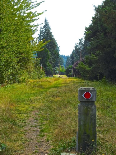 issue, at least with the naked eye. If linear corridors make it easier for animals to travel longer distances, it also makes it easier for parasites and disease to travel to new areas and new populations. Parasite and disease transmission increases as animals travel to places they would not otherwise be, creating territory and habitat overlap that otherwise would not have occurred. Deer, moose, and caribou using the same spaces can cause outbreaks to quickly spread between the species. This has the trickle-down effect of impacting community hunting practices, food security, and traditional land use.
Example: Effects on caribou
Let’s put the spotlight on one species that is of particular significance to many of our clients: caribou. Linear corridors disrupt the old-growth habitat that caribou need to survive. It takes a long time for the land to be established to the point that it can support the type of lichen that caribou eat in the winter. Linear disturbances reset forest succession — it sets back the clock in terms of reaching the required old growth habitats.
The establishment of linear corridors also changes the landscape and habitat by allowing increased human activity in the area, easy access for natural predators like wolves to catch caribou and other prey species, and opportunities for invasive species to spread and take hold. Caribou already have a variety of pressures from climate change and the increased intensity of forest fires, so adding the pressures of increased human activity, changes to food sources, and altered predator-prey interactions, increased disease transmission, and the loss of habitat that come with linear corridors further stress this already susceptible species. Monitoring can quantify the effects of these pressures and inform appropriate strategies for dealing with them.
“A permanent road base creates the conditions for a monoculture of vegetation. This is not great for biodiversity and can make it harder for wildlife and harvesters to pass through an area.” – SVS’s Alison Gamble
Placing “value” on the land
But how do we know there are species of importance in the area that we should be monitoring? Looking for the presence of indicator species or animal tracks can be a sign that a specific species, especially a species at risk, is present in an area. Monitoring can help us to place “value” on the land by determining that it could be critical plant or animal habitat.
Changes to predator-prey interactions
Predator-prey interactions can also change because of the presence of linear corridors. Looking along a corridor, is there a good line of sight for predators? Are predators and prey using these areas at the same time? If certain prey are a species at risk, like caribou for instance, a linear corridor that gives predators a good line of sight while hunting is an additional pressure on a species that should be monitored.
Linear corridors can also allow predators to cover more ground in a shorter amount of time. This issue can be compounded if landscape features or weather, such as deep snow, are already slowing down the rate of travel of a prey species, like caribou.
Plan for disturbances
Disturbances to the landscape might be unavoidable but properly timed environmental monitoring allows for potential problems to be identified and tracked or remediated as soon as possible. For instance, best practice construction environmental monitoring tasks like maintaining drainage patterns, inspecting sediment and erosion control measures, cleaning equipment to prevent the spread of invasive species, and monitoring access roads for animal mortality can prevent or mitigate potential adverse effects to adjacent natural areas like wetlands.
When/how/why should environmental monitoring be included in projects that create any type of linear corridor?
When: Annual monitoring during the growth season is best. We can get a better sense of the status of recovery during this time. It should happen before a project has occurred, if possible, and continue during and long after a project is complete.
How: Environmental monitoring should be stipulated in any type of plan such as an Environmental Impact Statement, decommissioning plan, or revegetation plan — any documents that outline what the intentions are after a project has been completed. Monitoring can be done with people on foot, with drones, with satellite imagery, or a combination of all three. There should be multiple plans that correspond to different outcomes, including unforeseen circumstances, that detail the methods, length of time, and frequency that an area will be monitored, as well as the conditions necessary for monitoring to cease.
Why: Accountability. Those responsible for the creation of a linear corridor have historically avoided responsibility after a resource has been tapped out. Long-term monitoring of these linear corridors avoids proponents being able to wash their hands of adverse impacts to the lands, waters, and people. It also helps set a standard of conduct that is based on responsibility and gets us closer to achieving a sustainable business model for resource management in Canada.
From baseline to restoration, monitoring is key
Environmental monitoring plays an important role in the planning, development, management, and remediation of projects that create linear corridors. “Environmental monitoring is step one in understanding an area and sets up a baseline to measure any changes or impacts, both expected and unforeseen,” says SVS’s Jasmine Labelle. When it comes to making informed decisions about potential courses of action surrounding a linear corridor project, some understanding of the landscape is necessary — how the land is used is crucial to determining what the best path forward is.
Eventually, linear corridors are no longer used for their intended purpose and decisions need to be made about what to do with the land. Environmental monitoring is necessary for planning these actions —do nothing, repurpose the corridor for another use (tourism, road access for a different project/proponent, etc.), or restore the corridor to match the surrounding landscape.
“Roads that are never properly restored are then used to access certain areas after the fact. A network of logging roads allows access to key areas but also opens access to the general public, a fact that comes with ecological considerations.” – Alison Gamble
Old logging roads
This is the kind of environmental monitoring-informed decision making that comes into play with corridors like legacy logging roads. These roads were created by forestry companies before there were regulations in place to hold resource extraction companies accountable for these disturbances to the landscape. And while these roads aren’t anyone’s responsibility anymore, they are present, they are being used for other purposes, like recreation and as access roads, and they are impacting plant and animal life in the area. Often these roads are economically beneficial to small nearby towns who rely on tourism dollars from recreational users coming into the area and can provide access to important hunting and trapping areas for local residents. As such, there can be some resistance to the idea of remediating and restoring these areas. Environmental monitoring becomes an important step in assessing the options and deciding on the best course of action.
What else can environmental monitoring tell us?
Environmental monitoring can tell us a lot about land use – current and future. It can also help us plan more carefully for future disturbances and how they should best be managed. Here are some specific things we can learn and consider:
- How the area is being used: Human activity such as chain-sawed trees, bait, tree stands, ATV or snowmobile tracks are common along linear corridors. Human activity has a very large impact on how well the land can recover as well as if restoration methods will be undone or vandalized.
- What extra steps might be needed: Additional interference may be required such as tree felling to prevent human access, planting to support regrowth, tilling to undo soil compaction, or any other land preparation method.
- How the land has changed over time: What can we learn from these disturbances that can inform the long-term plans of other industries best practices? Did the corridors that were only used in the winter recover faster than others? Can proponents limit future corridor use to winters to better support regrowth? Did the road get taken over by snowmobiling and ATVs? Can a proponent partner work with a local organization to establish formal trails after they are finished using a corridor?
- Which land use options are worth pursuing: Sometimes restoration isn’t always the best option and decisions should be made based on what is the most realistic/best use of the land going forward.
.png?width=1024&name=MicrosoftTeams-image%20(12).png)
The Role of Community-led Environmental Monitoring
One common theme woven throughout environmental monitoring is that things can be missed if community members are not present and engaged in the process. At the community level, having trained environmental monitors means the community has ears and eyes on the ground protecting their interests during proponent-led assessments. These monitors provide an extra level of accountability to ensure assessments are being done fully. They are also able to provide community and historical context as they have first-hand knowledge of problem areas and sites of potential contamination.
To learn more about community-led environmental monitoring, our Five Key Questions to Plan a Community-led Environmental Monitoring Program is a great place to start!
Example of community-led corridor monitoring done right: The Henvey Inlet Wind Project
“Environmental monitoring is important for collaboration between Nations and can facilitate relationships. It’s important to have data collected and have something to share.” – Jessica Ward, SVS
At 300 MW, the Henvey Inlet Wind Project is the largest single-phase wind project in Ontario and the largest First Nation wind partnership project in Canada. Nestled in the Henvey Inlet First Nation reserve on the shore of Georgian Bay, the wind farm’s transmission line spans more than 86 km to connect electricity generated by the wind farm into electricity grid near Parry Sound.
The Henvey Inlet Wind Project is an example of environmental monitoring done right, at the right time, following best practices for environmental assessments. During transmission line construction, baseline monitoring allowed for planning and accommodation for species that were sensitive to habitat fragmentation or could be otherwise impacted by the project. Environmental monitors and qualified biologists were hired from among community members of three First Nations, providing training and employment opportunities for the communities. The First Nations communities were able to play a role in determining permitting, monitoring, and environmental assessments on their own land. Henvey Inlet First Nation developed their own environmental assessment (EA) requirements under their land code, as well as had the proponent meet both the provincial and federal EA requirements. The success here set the stage for Magnetawan First Nation and Shawanaga First Nation to each permit the transmission line on their land as well, under their respective land codes. In doing so, these Nations set the mitigation and monitoring requirements the proponent had to follow for the project to get approved, and then they each had a role in overseeing how those measures were implemented by the proponent.
Why did the turtle cross the road? Incorporating training in environmental monitoring planning
Anywhere a linear corridor is constructed, there will be an impact to wildlife. The earlier that monitoring begins, the better. In one story shared by SVS’s Jessica Ward, environmental monitoring was built into the construction phase of the Henvey Inlet Wind Project, and construction staff were trained to identify and protect species of interest. In this case, vehicles were travelling on roads that bordered habitat for species at risk — turtles and rattlesnakes. Environmental monitors searched the construction footprint each morning for snakes and turtles before heavy equipment was moved in. Any that were found were relocated safely by environmental monitors who were trained in proper handling techniques. The environmental monitors used decoy snakes and turtles to make sure construction staff were checking around and under their vehicles for these important species and keeping a look out for them when driving on project access roads. Turtle fencing with passages under the roadways were used to keep turtles off the road; this required ongoing monitoring to ensure they were functioning properly and not in need of repairs.
Are You Looking for Help With Your Environmental Monitoring or Guardians Program?
Please give us a shout. Our team would love to chat through all your options. Or just chat about environmental everything. We are a self-declared group of science nerds who always have time for everything from bats and turtles to caribou and eels and all the systems that nurture and sustain what matters on our planet!
Download our FREE ebook which is full of useful information about Environmental Monitoring!

ENVIRONMENTAL MONITORING AND ADVISORY SERVICES at SVS:
Rights and Interests-based Technical ReviewsScientific Advisory Support
Environmental Monitoring
Guardians Program Development
Source Water Protection
Flood Mapping
Climate Change Adaptation
Nature Based Solutions to Climate Change
No matter what stage of a project you are dealing with, we’ve got you covered. Our services integrate to help you reach your goals.
PROTECTING WHAT MATTERS
Protecting your lands and waters is a crucial part of upholding your rights and supporting community well-being. Our team strives to understand your Nation’s values so we can walk alongside you in protecting what matters most.
Whether you need to conduct baseline studies of your waterways, establish a Guardians program, or are looking for strategic scientific advice on the risks of a proposed development, we are here to help in the ways that will be most effective and meaningful.
Our advice and recommendations rest on deep and wide experience and knowledge across many scientific disciplines:
- Aquatic and terrestrial ecology
- Environmental planning
- Wildlife biology
- Endangered species
- Contaminated sites
- Geological sciences
- Water resources management
- Waste management
- Hydrogeology
- Stream restoration
- Fish biology
- Environmental chemistry and toxicology
- Climate change adaptation planning
- Nature based solutions to climate change
Read Our Full 2021 Services Brochure Here To Find Out What Other Great Services We Offer
Get more posts like this directly to your inbox! Sign up for our bi-weekly funding, news and information digest:

About Us: Shared Value Solutions
We are an Canadian B Corp, and we assist Indigenous communities with support throughout regulatory processes surrounding major development projects like mines, hydroelectric facilities, transmission lines, highway expansions, oil and gas pipelines, natural resource transport applications and nuclear power.
We have deep context and experience behind the recommendations we provide, having worked for our clients on almost every major project in Canada over the last 10 years. For us, it’s all about building long-term relationships with our clients. We want to get to know you and what you want to do so we can help you move your plans forward.
- Impact Benefit Agreement Negotiation Support
- Technical Reviews and Regulatory Process Support
- Community and Economic Development Planning
- Indigenous Knowledge and Land Use Studies
- Environmental Monitoring
- Guardians Program Development
- Climate Change Readiness
- GIS and Mapping
- And so much more: www.sharedvaluesolutions.com