
-1.png?width=800&name=MicrosoftTeams-image%20(11)-1.png)
Welcome to the final post in our blog series that explores the power of mapping and GIS in supporting Indigenous Nations to advance their rights and interests. Over the series, we’ve explored everything from custom collector apps for land users to support land management decisions to Indigenous Knowledge mapping, Story Maps, cumulative effects mapping, and more. Today’s story is an example of one project that combines many of these approaches. We hope it paints a clear picture of the power of GIS and mapping to help protect what matters.
Eight Ways GIS Supports IPCA Development
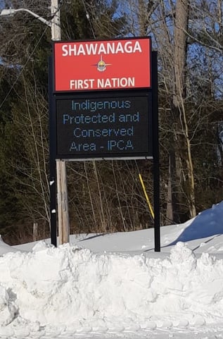
When Shawanaga First Nation set out to establish an Indigenous Protected and Conserved Area (also called an IPCA) on Shawanaga Island in the beautiful waters of Georgian Bay, Ontario, their team faced many challenges that had one thing in common: the relationship between Shawanaga members and the lands and waters. A key tool they’ve used to celebrate, redefine, and reignite that rich and abiding relationship is GIS.
Three years into this project, we have counted no less than eight ways the team at Shawanaga has used GIS in the process of establishing their IPCA. We have had the privilege of supporting this work and are excited to share these examples with other Nations who might be contemplating setting up their own IPCAs.
What is an Indigenous Protected and Conserved Area?
An Indigenous Protected and Conserved Area is a place where Indigenous Peoples lead the protection and care of the lands and waters using Indigenous laws and Knowledge. As our friends at the Indigenous Leadership Initiative explain, “determining the future of traditional territories is at the root of Indigenous Nationhood. With IPCAs, Indigenous Nations hold the pen when lines are drawn on the map, sit at the table when decisions are made, and are on the ground caring for lands and waters through Indigenous Guardians programs.” Studies around the world have found that Indigenous-led management leads to better conservation outcomes when compared with government-managed protected areas. In recognition of the critical role of IPCAs in the protection of lands across Canada, and in support of the achievement of Canada’s Target One under the international Strategic Plan for Biodiversity, Canada has provided funding for Indigenous Nations to establish IPCAs. There are currently close to 30 IPCAs in development across Canada, of which Shawanaga Island is one.
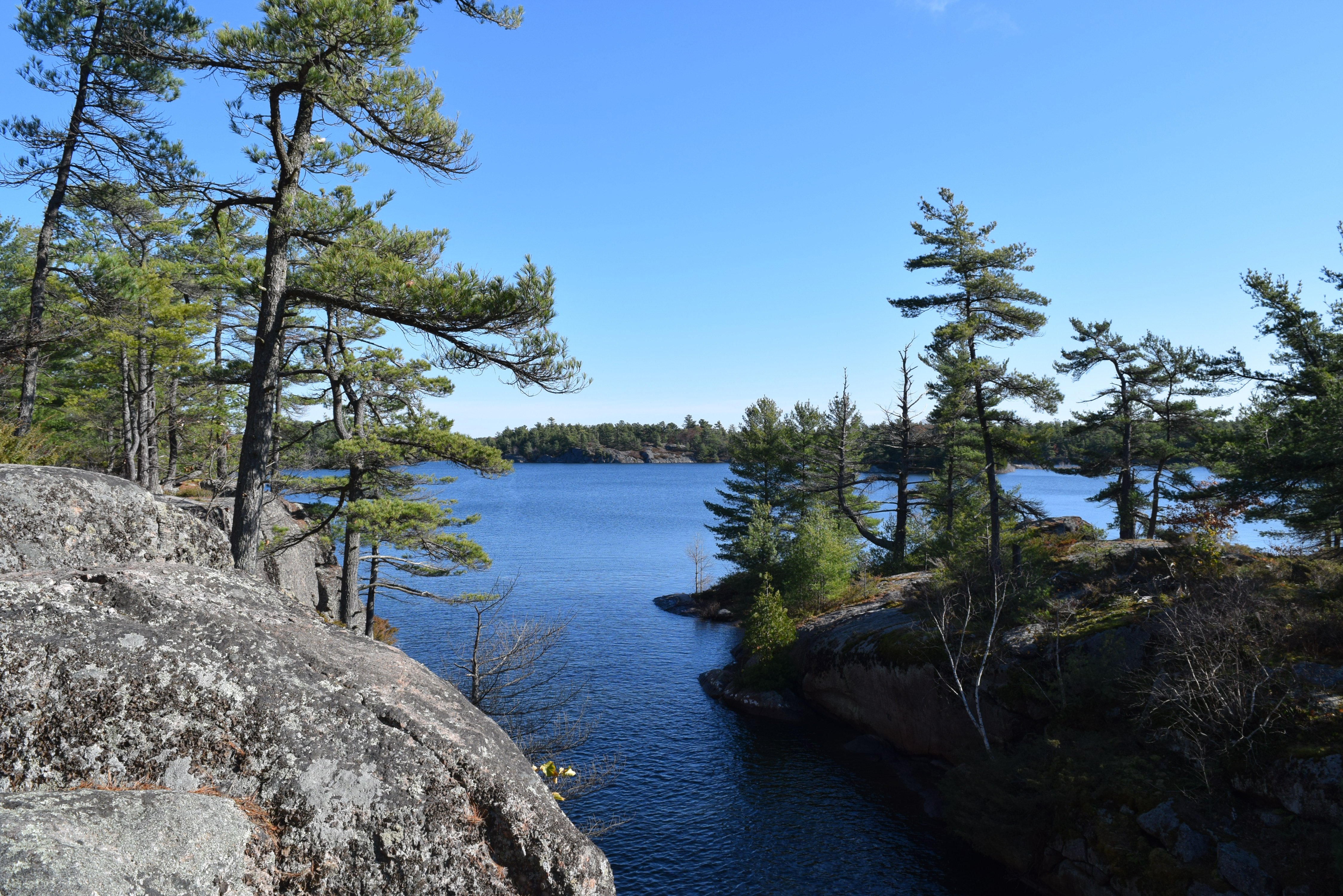
About Shawanaga Island IPCA
The island is in the Traditional Territory of Shawanaga First Nation and consists of 1020 hectares of land, inland waters, coastline, and nearshore waters. “For Shawanaga First Nation, the Shawanaga Island IPCA acknowledges our history and rights and responsibilities as keepers of the land. The Island, itself, is ecologically important. Its forest and wetland habitats are home to culturally important and ecologically significant plants and animals. We want to protect the species that live on the Island in balance with greater use and stewardship of the island by members,” writes Kyla Judge, Councillor and Shawanaga First Nation member.
Check out their beautiful website for more
information: Shawanaga Island - Indigenous Protected and Conserved Area (shawanagaislandipca.ca)
The management of the island will be guided by Anishinabe values, teachings and practices that have been passed down through the generations. As Kyla says, “We will lead the protection and care of the Shawanaga Island IPCA using our own laws, governance and knowledge systems as well as western science and management principles. The Georgian Bay coast and islands have been home to us, the Anishinabe of Shawanaga First Nation, for thousands of years. By creating the IPCA, we are rebuilding connections to the Island that have been lost in recent generations.”
GIS Helps Address Challenges of IPCA Development
This loss of connection Kyla is referring to was just one of several challenges facing the team at Shawanaga as they began their planning for the IPCA. Another was the lack of clarity around how boundaries of the IPCA should be determined and then acknowledged by Canada and Ontario. Another was how best to care for the lands and waters using a combination of Anishinabe Knowledge and western science. Yet another was how to best communicate their plans to neighbours, cottagers, and others who have come to love and use the island as well. In the sections below we’ll explore how GIS and mapping became a central tool in addressing each of those challenges – and more.
GIS Tool #1: Indigenous Knowledge Mapping
At the beginning of the process to establish the IPCA, our social researchers teamed up with Shawanga to interview Shawanaga First Nation members about their use of the Island, and to gather Oral History about the Nation’s connection to it over time. On an ArcGIS Online digital map of the area, land users and Knowledge Holders pointed out areas on the island that held specific value to them for harvesting or staying out on the land, or held other cultural or spiritual significance. They also shared their Ecological Knowledge, identifying places that were sensitive, needed protection, or were potential future sites of information or interpretation centres. Their sharing told the story of the different ways members used the land and waters in the past, how they use these special places in the present, and provided ideas for how members might choose to use the island into the future.
The Indigenous Knowledge study was a great place to start because it helped to identify the goals and vision for the IPCA and began to define the area for the IPCA.
For more on Indigenous Knowledge mapping, check out this blog. For ideas on how to leverage online GIS tools to gather Indigenous Knowledge during these remote research times, read this blog. Better still, download our free eBook for a whole collection of articles on Indigenous Knowledge research.
GIS Tool #2: ArcGIS Online Tools for Real-time Land Management Decisions – and GIS Training
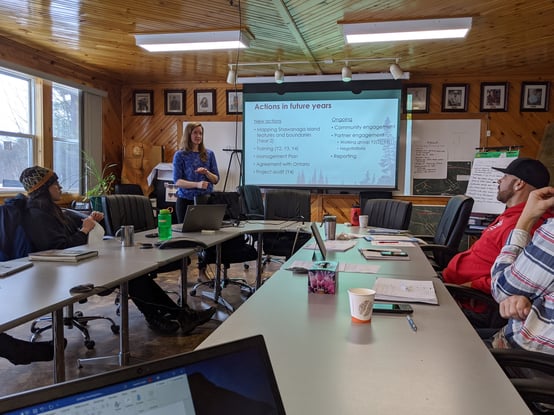
A big piece of the success of the IPCA depends on Shawanaga First Nation having the internal capacity to manage it effectively over the long term. Key to making well-informed land management decisions is access to in-house GIS tools and mapping. If you’ve been following our blogs, you’ll know that at SVS we love Esri ArcGIS for its robust capabilities and access to ongoing learning and improvements (and no, they aren’t paying us to say that!).
The team at Shawanaga opted to set up an ArcGIS account. Our resident GIS expert, Lynn Wardle, worked closely with the Shawanaga team to get them up and running with the software. After a bit of training, the team was prepared to create surveys for the community to collect and submit data (more on that below), to interpret and make sense of the data coming in, and to produce maps that will support the development and management of the IPCA. This GIS training is some of our favourite work at SVS. Call Lynn if you’d like to hear more about it. She’s always up for a chat on this topic!
For an overview of GIS, and ArcGIS Online, read our FAQ blog.
For more about GIS training, and how the team at nearby Magnetawan First Nation tooled up to help protect endangered turtles, read this blog.
GIS Tool #3: ArcGIS Surveys Using Survey123
A third way that the team gathered information to understand how Shawanaga members and non-member neighbours currently use the island was through an online survey built using Survey123. With a bit of practice, creating these surveys really is as easy as 123 – according to Lynn! Available on the Shawanaga website, shared through social media, and distributed by local conservation groups, municipal government, and the local cottagers’ association, the survey showed maps of the island and surrounding area and invited participants to mark the locations of different uses, such as camping, picnicking or hiking. The surveys were a big hit with members and non-members alike. People who love and use the island submitted valuable data to inform the process of determining what areas need greater protection, and what areas are popular destinations for recreation and leisure. It helped everyone to feel part of the creation of the IPCA and the plan for its future.
Perhaps the coolest part of this data gathering exercise was the way all the submissions were monitored live in an ArcGIS Dashboard. The project team watched the dashboard closely to make sure that data was being collected in a meaningful way, and that enough information was being gathered to make informed decisions. The team noticed in real time that the survey was being completed by lots of local residents and cottagers, but not many Shawanaga members. The ArcGIS Dashboard allowed the team to see what was happening, and pivot with distribution methods and timelines to ensure that Shawanaga members were also able to provide their input on the survey. Without the ability to see real time results in the ArcGIS Dashboard, the team would not have realized the data gap until after the survey was closed and all of the data was compiled and analyzed.
For more about data collection using Survey123, read this blog.
GIS Tool #4: Data Collection App to Map Current Use
After the Indigenous Knowledge study had given the team a strong sense of how Shawanaga First Nation members, and the general public, had been using the island, the team grabbed some canoes and hiking boots and headed out on the lands and waters for a closer look. They surveyed existing trails and campsites, marked potential locations for future campsites and trail systems, and visited sensitive sites identified by Knowledge Holders.
“The team recorded data in the field using ArcGIS Survey123,” Lynn explains. “We downloaded the free app to their phones where they were able to access a survey that was available for use both online and offline. Making use of available satellites, field staff were able to mark locations for campsites and take photos of the land. This information was uploaded to the ArcGIS Online cloud (no paper transcription or GPS downloads required) and was instantly available to SHAFN IPCA staff to view and share with SVS.”
For more on this app and how it works, read this blog and this blog.
GIS Tool #5: ArcGIS Story Map Shares the History of the Island
Fostering connection between all who share a love of Shawanaga Island is a very important element to the development of the IPCA. “we envision a future where the IPCA will be a place of reconciliation amongst all walks of life, lands, and waters. Including, Indigenous and non Indigenous people.” says Kyla.
To help non-Indigenous visitors and cottagers better understand the centuries-long relationship that Shawanaga ancestors have with the islands and waters, the ways members currently use it, and the vision for the future, Shawanaga built a beautiful, interactive online story map. If you are new to the term, please check this one out – one visit will explain it all:
.png?width=1760&name=IPCA%20Story%20Map%20(2).png)
The Story Map combines photos, videos, quotes and, of course, many maps to tell the long story of occupancy and use of Shawanaga Island. You’ll find everything from modern day maps showing the Island and historic trade routes and trading relationships to very old maps from before the treaties. The Story Map includes settler history on the island, including the Ojibway Hotel, from the perspective of the Shawanaga members whose families worked there.
“We want to increase the awareness of Shawanaga First Nation and the Shawanaga Island IPCA at the local, provincial, and national levels. Sharing who we are as a people—about the ecology of the islands, the importance of the islands, Anishinabek culture and our teachings, and our interconnected history—is important to help break down barriers and promote healing and positive relationships across all peoples and cultures,” observes Kyla.
A second Story Map is currently under development to communicate the management plan for the IPCA.
GIS Tool #6: Mapping to Delineate the IPCA Boundary
As the folks at ILI so eloquently stated, “Indigenous Nations hold the pen when lines are drawn on the map” for IPCAs. However, choosing the boundaries that will delineate an IPCA is no easy business. At this point in the process, the team has combined the input from the Indigenous Knowledge mapping, the online survey data, on the land data collected by staff, and Ontario’s previously proposed Conservation Reserve boundaries for the area to create a preliminary boundary map. Local partners also shared data that allowed the team to make sure any privately held lands were excluded from the IPCA boundary.
“We made a digital map of the boundary that includes all of the different inputs and layers to allow for a more fluid conversation with Shawanaga staff and leadership,” explains Lynn. “Unlike a standard paper map, they can zoom in and out, click on features to get more information about them, and turn layers on and off. The idea is that they can more easily identify places that should be “in” or “out” of the IPCA.”
This style of digital mapping is about the availability of information and the ability to make iterative decisions quickly. The eventual end goal is to present the defined IPCA boundaries to Ontario and Canada, so that everyone is entirely on board and aligned with the scope and objectives of the IPCA. The final map will have to tell a clear and compelling story that everyone involved can get behind if the IPCA is to be a sustained success. A key indicator of success in establishing an IPCA is being able to clearly communicate the area that is being protected and conserved!
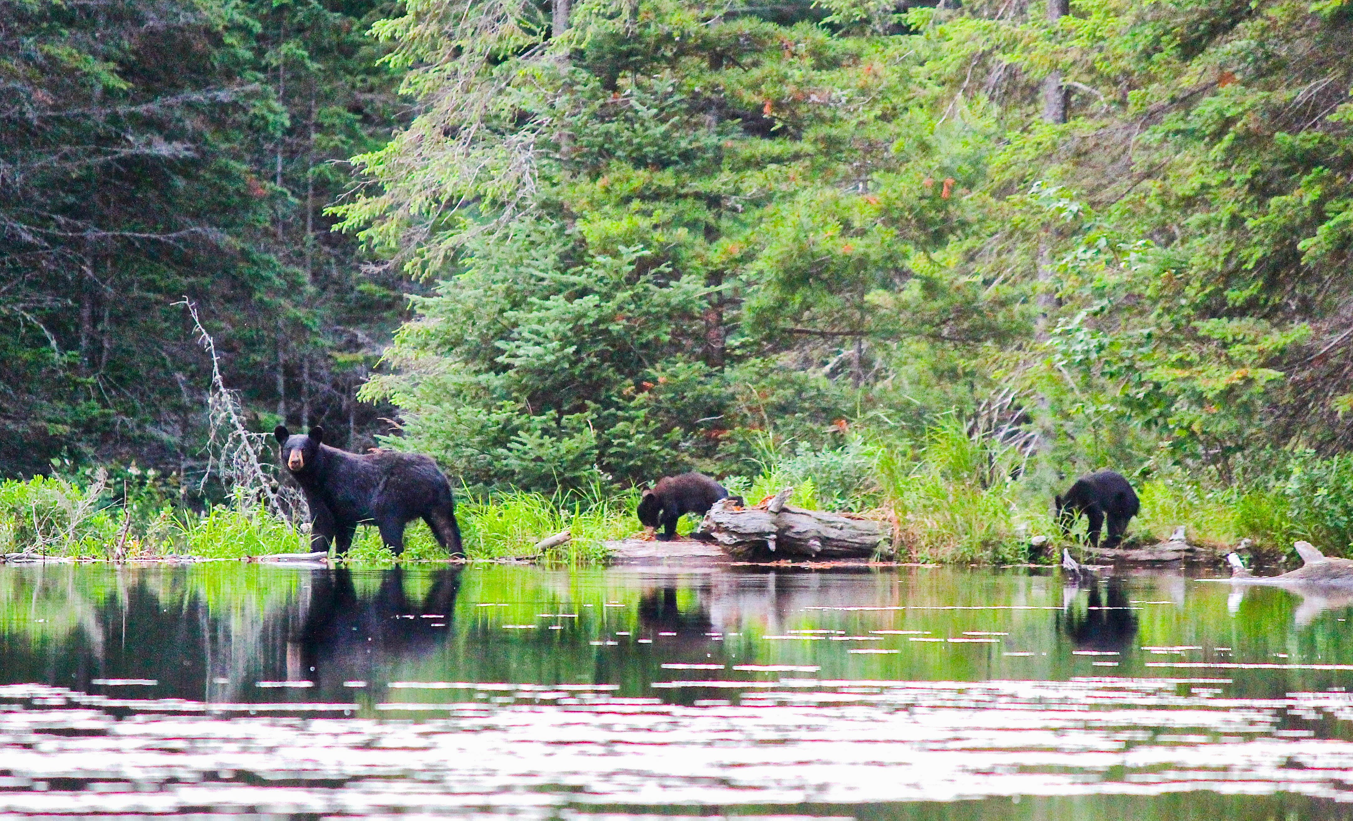
Photo credit: Steven Kell
GIS Tool #7: Ecological Land Classification Mapping
The team at Shawanaga is keen to work with university partners, conservation groups and other folks who have approaches and techniques that will enhance the protection of the lands and waters. These last two mapping tools are examples of those partnerships in action.
According to Ed Wiken Introduction to the Ecological Land Classification (ELC) 2017 (statcan.gc.ca), who helped develop it, Ecological Land Classification is “a process of delineating and classifying ecologically distinctive areas of the surface. Each area can be viewed as a discrete system which has resulted from the mesh and interplay of the geologic, landform, soil, vegetative, climatic, wildlife, water and human factors which may be present.”
The Shawanaga team has been out working alongside LGL Limited to add this layer of understanding – and mapping - to the IPCA. The ELC data will add a rich layer of information to our existing maps, to help plan for the management and stewardship of the IPCA. While the applications for this data will be plentiful, some immediate uses will include helping the team confirm areas of ecological sensitivity that should be avoided by visitors, and how to best plan trails so visitors can experience the beauty of the Island without having to trek for kilometers through a swamp! The team envisions using this ELC data well into the future, in combination with all the other rich data described above, to help make important decisions for how to best manage the lands and waters of the IPCA.
GIS Tool #8: Applied Geomatics to Identify Potential Habitats and Restoration Locations
A large part of the establishment of the IPCA has been exploring how Shawanaga can partner with academics and organizations to form meaningful relationships and accomplish mutual goals. Last spring, Shawanaga partnered with a fourth-year applied geomatics course at the University of Guelph to help identify areas for future stewardship projects related to the IPCA. The students used their final course projects as a platform to use GIS and modelling to identify suitable habitats for lake sturgeon spawning and areas for restoring habitat of important plant species, and to show how the IPCA could support restoration efforts.
So there you have it. One large and inspiring project. Eight ways GIS and mapping tools are supporting its success – and counting. Please check out the links summarized below for more examples of GIS in action and download our new eBook that contains them all.
Happy mapping, everyone!
%20(1).jpg?width=4032&name=KellSteven_GBshoreline_2019%20(8)%20(1).jpg)
Photo credit: Steven Kell
Blog Series: GIS and Mapping
Harness the power of the map for better, more informed decisions
Welcome to our blog series that explores the power of mapping and GIS in supporting Indigenous Nations to advance their rights and interests. GIS stands for Geographic Information Systems. Many of us know the term, but if you are fuzzy on what it actually means, you're not alone! Throughout this blog series and in our upcoming eBook we will explore what it is, how it works, and some of the amazing things you can do with it.
Other posts in this series:
Better still, download our free eBook for the whole collection of articles from this series as well as more material to inspire your own GIS and mapping projects!

GIS and Mapping Services at SVS
Our goal is to make it easy for your Lands Department to have control over your maps of your territory. Our services are scalable to your needs. We can come along side your team and support as you build in-house capacity, chose to outsource your mapping needs, or something in between. We leverage Esri ArcGIS tools to allow for accurate, real-time data collection, analysis, and more:
• Field data collection made easy
• ArcGIS StoryMaps
• Real-time data visualization
• Training programs
• And of course, any map you could ever need!
Read Our Full 2021 Services Brochure Here To Find Out What Other Great Services We Offer
Get more posts like this directly to your inbox! Sign up for our bi-weekly funding, news and information digest:

About Us: Shared Value Solutions
We are an Canadian B Corp, and we assist Indigenous communities with support throughout regulatory processes surrounding major development projects like mines, hydroelectric facilities, transmission lines, highway expansions, oil and gas pipelines, natural resource transport applications and nuclear power.
We have deep context and experience behind the recommendations we provide, having worked for our clients on almost every major project in Canada over the last 10 years. For us, it’s all about building long-term relationships with our clients. We want to get to know you and what you want to do so we can help you move your plans forward.
- Impact Benefit Agreement Negotiation Support
- Technical Reviews and Regulatory Process Support
- Community and Economic Development Planning
- Indigenous Knowledge and Land Use Studies
- Environmental Monitoring
- Guardians Program Development
- Climate Change Readiness
- GIS and Mapping
- And so much more: www.sharedvalues